Planning this trip?
Save it, share it with your crew, or find travelers heading the same way.
Trip Snapshot
- Duration: 5 Days / 4 Nights
- Base Town: Shelter Cove (southern trailhead) or Mattole Beach (northern trailhead)
- Permits: Required for overnight stays, obtained via Recreation.gov
- Fees: $6 per person, plus $10 reservation fee (check current rates)
- Best Months: May, June, September, October
- Drive from Nearest Airport: Arcata-Eureka Airport (ACV) to Mattole Beach: ~2.5 hours; to Shelter Cove: ~3 hours
- Difficulty: Strenuous (due to tides, sand, and elevation changes)
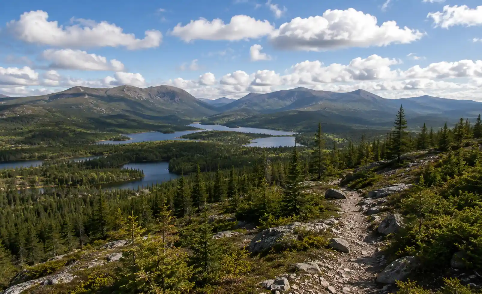
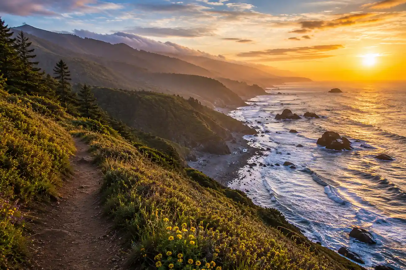
The Lost Coast Trail offers a challenging and rewarding backpacking experience along California's most undeveloped coastline. This 5-day itinerary focuses on the popular 25-mile section from Mattole Beach to Black Sands Beach, requiring careful planning around tides and shuttle logistics.
Day 1 — Arrive, Shuttle, and Hike to Peter Johnson Creek (8.3 miles)
Your Lost Coast adventure begins with logistical planning. Most backpackers arrange a shuttle from the southern trailhead (Black Sands Beach in Shelter Cove) to the northern trailhead (Mattole Beach) to avoid a long drive after the hike. Allow ample time for the shuttle and pre-hike preparations.
The first section of the trail from Mattole Beach involves hiking along the beach and navigating around Punta Gorda, a critical tidal zone. Ensure you cross Punta Gorda at low tide. Continue along the varied terrain of sand, cobble, and occasional rocky sections to your first overnight camp at Peter Johnson Creek.
Day 2 — Peter Johnson Creek to Big Flat (7.3 miles)
Today's hike continues south, offering stunning views and more tidal zone crossings. Be mindful of the tide charts, especially around Sea Lion Gulch and Telegraph Creek. The trail alternates between sandy beaches and rocky headlands, demanding attention to footing.
You'll pass several potential campsites, but Big Flat provides a spacious and scenic area for the night, often with fresh water available from the creek. Take time to explore the expansive beach and enjoy the solitude of this remote coastline.
Day 3 — Big Flat to Randall Creek (6.5 miles)
This section of the Lost Coast Trail is known for its dramatic scenery and challenging terrain. You'll encounter more significant tidal challenges, particularly south of Big Flat. Plan to cross these areas during low tide windows to ensure safe passage.
The trail continues to weave along the coastline, with opportunities to spot wildlife such. Randall Creek offers a good camping spot, often sheltered and with access to water. Prepare for a shorter, but potentially more demanding, day due to the varied coastal conditions.
Day 4 — Randall Creek to Miller Flat (4.0 miles)
Today is a shorter hiking day, allowing for a more relaxed pace and time to explore the immediate surroundings. The terrain remains rugged, with a mix of beach hiking and negotiating rocky sections. Continue to consult your tide charts for safe passage.
Miller Flat provides another excellent camping option with good access to water. This allows you to position yourself for a manageable final day and enjoy a last night under the stars on the Lost Coast.
Day 5 — Miller Flat to Black Sands Beach (2.5 miles)
Your final day on the Lost Coast Trail is a relatively short hike to the southern trailhead at Black Sands Beach in Shelter Cove. This section still requires attention to the tides, but the shorter distance makes it less critical than previous days.
Upon reaching Black Sands Beach, you'll find your shuttle vehicle (if pre-arranged) or parking. Take a moment to reflect on your journey through this unique and wild landscape before heading back to civilization.
Logistics & Wilderness Rules
Permits (2025-2026)
Overnight permits for the King Range Wilderness (Lost Coast Trail) are required year-round and are managed through Recreation.gov. Permits are released in two windows:
- Spring/Summer (March 1 – July 31): Permits released on November 1st of the prior year at 7:00 AM PST.
- Fall/Winter (August 1 – February 28): Permits released on May 1st of the same year at 7:00 AM PST.
Demand is extremely high, especially for weekend dates and during peak seasons. Be ready to book exactly when permits are released. The fee is $6 per person, plus a $10 reservation fee per permit (check current rates on Recreation.gov).
Tides
Hiking the Lost Coast Trail requires careful planning around ocean tides. Several sections are impassable at high tide. Obtain a tide chart for Shelter Cove (or Mattole Beach) for your specific dates and plan your daily mileage accordingly. Aim to cross critical sections (Punta Gorda, Sea Lion Gulch, Telegraph Creek) during low tide windows.
Bear Canisters
Bear canisters are mandatory for food storage and scented items. This is strictly enforced due to active bear populations in the area. Soft-sided bear bags are not sufficient.
Water
Water sources are seasonal and can be unreliable, especially later in the dry season. Always carry sufficient water and a reliable filter/purifier. Be aware that some creeks may be brackish near the ocean.
Human Waste
Packing out human waste is required. WAG bags (Waste Alleviation and Gelling bags) are mandatory. Do not bury human waste on the beach or in the dunes.
Fires
Campfires are generally prohibited along the Lost Coast Trail. Check current fire restrictions before your trip.
What to Bring
This is a remote and challenging backpacking trip. Your packing list should reflect self-sufficiency and preparedness for varied coastal weather.
- Backpack: 60-75 liter capacity.
- Tent: Freestanding, wind-resistant.
- Sleeping Bag: Rated for 20-30°F, even in summer.
- Sleeping Pad: Insulated.
- Bear Canister: Mandatory.
- Water Filter/Purifier: Plus backup treatment.
- WAG Bags: Sufficient for your trip duration.
- Navigation: Map, compass, GPS device/app (downloaded offline maps).
- Headlamp: With extra batteries.
- First-Aid Kit: Comprehensive.
- Sun Protection: Hat, sunglasses, sunscreen.
- Rain Gear: Waterproof jacket and pants.
- Layers: Synthetic or wool base layers, mid-layer fleece/puffy.
- Hiking Boots: Broken-in, waterproof, good ankle support.
- Camp Shoes: Sandals or lightweight shoes for stream crossings and camp.
- Food: Sufficient for 5 days, plus extra.
- Trekking Poles: Highly recommended for stability on sand and uneven terrain.
- Tide Chart: Printed and understood.
- Trash Bags: Pack it in, pack it out.
Best Time to Go
The Lost Coast Trail is best hiked in the shoulder seasons to avoid summer crowds, fog, and winter storms.
- Spring (May-June): Generally mild temperatures, less fog than summer, and wildflowers. Water sources are usually reliable.
- Fall (September-October): Often clear skies, warmer ocean temperatures, and fewer people. Water sources may be scarcer.
- Summer (July-August): Can be very foggy, crowded, and hot.
- Winter (November-April): Frequent storms, heavy rain, high winds, and potentially impassable creek crossings. Not recommended for most backpackers.
FAQs
Hiking the Lost Coast Trail: 5-Day Backpacking Itinerary FAQs
How difficult is the Lost Coast Trail?
Do I need a permit for the Lost Coast Trail?
When should I book my Lost Coast permit?
What about tides on the Lost Coast Trail?
Are bear canisters required?
How do I arrange a shuttle for the Lost Coast Trail?
What is the best time of year to hike the Lost Coast?
What other travelers are saying
Be the first to leave a tip or question for the next traveler.

Did this guide help you?
Want our free Google Maps of the best outdoor spots?
A hand-picked Google Maps list of the best hiking, kayaking, and camping spots across the US, sent straight to your inbox.